Heat, humidity and hard choices: Lessons from Belém’s climate risk analysis
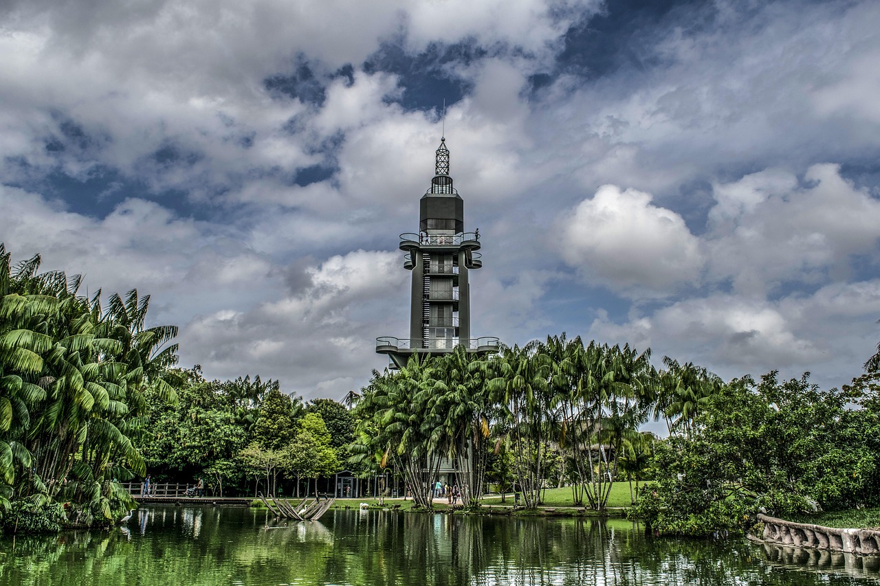
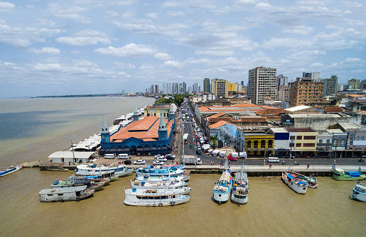
Belém, the capital of the state of Pará in northern Brazil, is an unlikely place to talk about heat as a crisis. The city sits at the edge of the Amazon rainforest, surrounded by rivers, parks, and some of the richest biodiversity on the planet. Green spaces like the Utinga State Park, the Emílio Goeldi Zoobotanical Park, and Mangal das Garças offer genuine pockets of shade and microclimate regulation. The Ver-o-Peso market opens onto the Guajará Bay. Water is everywhere.
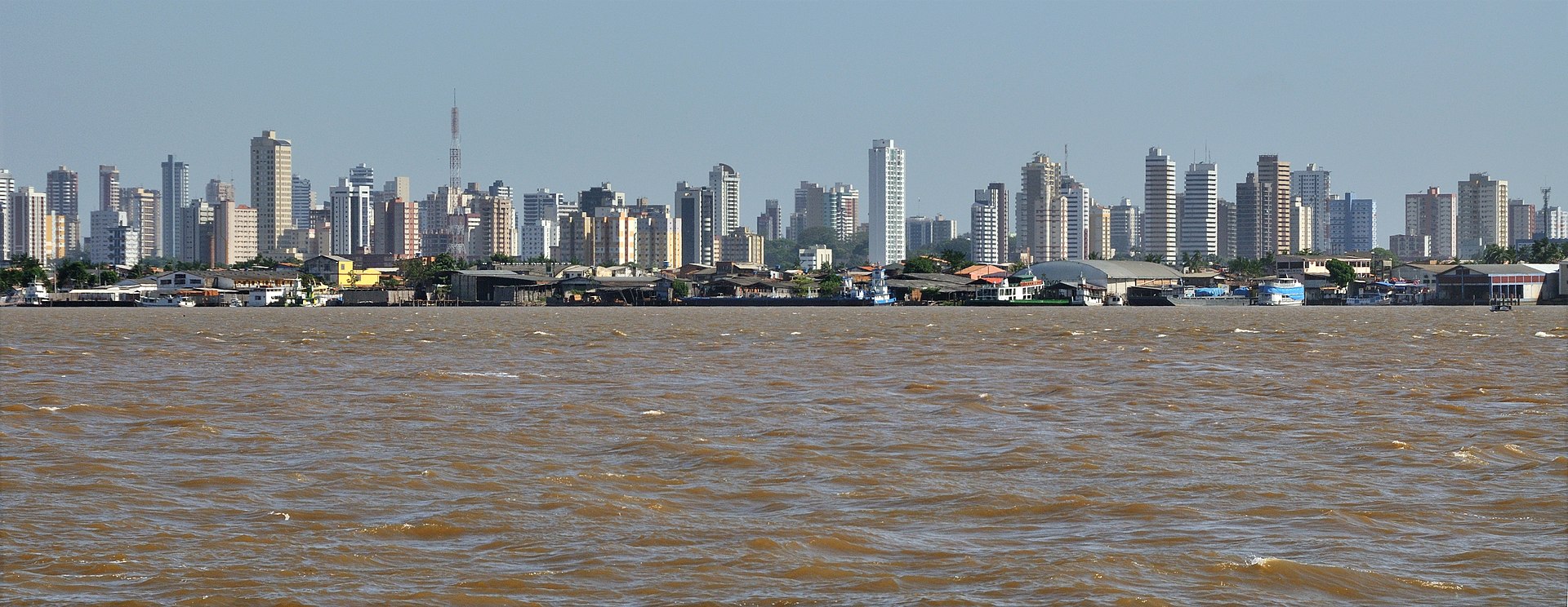
And yet, a different picture emerges when walking through the southern neighborhoods on an August evening, which is when the rains ease and the sun has been pressing down all day. The asphalt holds the heat long after dark. The air, thick with humidity that rarely drops below 84 percent, offers no relief. There are few trees. Buildings sit close together, walls still warm to the touch. For an elderly resident, a child, or a family in informal housing with poor ventilation, the night brings no respite.
Belém sits close to the equator, where average temperatures exceed 26°C year-round. The natural conditions are already warm and humid. Add dense construction, expansive asphalt, and low vegetation cover in parts of the city, and heat becomes a compounding daily problem, not just a seasonal one.
This tension between Belém’s natural wealth and its urban vulnerabilities is precisely what the Climate Risk and Vulnerability Analysis (CRVA), developed by ICLEI South America as part of the Nature-Based Cities (NBCities) project, set out to map and understand. The city has been proactive on this front: It joined ICLEI in 2022, carried out its first greenhouse gas emissions inventory in 2023, and commissioned this analysis as part of a broader push toward evidence-based climate planning. To discuss what the findings mean in practice, we spoke with Tiago Mello, Project Officer at ICLEI South America and one of the authors of the analysis.
What makes a heat island in a city like Belém?
“Urban heat islands are not simply a product of climate change. They are, first and foremost, a product of urban design – or the lack of it,” Tiago notes. The phenomenon occurs when dense construction, impermeable surfaces, and low vegetation concentrate in the same areas, and the heat absorbed during the day has nowhere to go at night. It is quantified by the difference between these given urban areas compared to its natural surroundings.
The CRVA identified urban heat islands as one of the predominant climate risks for Belém, alongside flooding and coastal erosion. Notably, the analysis found that the average maximum air temperature is projected to change by less than 0.5°C between current conditions and 2040. That modest figure can be misleading. As Tiago explains, the heat island effect is driven less by regional temperature trends and more by how the city is built. In humid conditions, the body struggles to cool itself efficiently, and more than half of Belém’s dwellings sit in dense informal settlements with extensive impermeable surfaces and very little tree cover. This is where heat accumulates most severely, and where the gap between the city’s green surroundings and its urban reality is most stark.
From phenomenon to risk: who is exposed?
What distinguishes a climate risk analysis from a standard climate study is the question of who bears the risk. Drawing on the IPCC conceptual framework, the CRVA combines three components: Threat, exposure, and vulnerability. Exposure includes population density, income levels, the presence of favelas and social housing, the presence of indigenous communities, and the concentration of sensitive age groups; namely, children under ten and elderly people over sixty, both of whom face heightened health risks from extreme heat.
The neighborhoods showing the highest overlap of heat risk and social vulnerability include Condor, Barreiro, Sacramenta, Pedreira, Mangueiras, and Tapanã. These are densely populated areas in the southern part of the city where limited vegetation, high surface temperatures, and socioeconomic pressures converge. “Making these people visible in the data is not incidental. It is what gives the analysis its policy value,” says Tiago.
When heat meets water
One of the more important insights of the CRVA is that heat does not operate in isolation. According to Tiago, “Belém faces overlapping climate risks, and the same patterns of urban development drive them simultaneously.” Impermeable surfaces and lack of vegetation intensify heat islands, prevent water infiltration, and worsen flooding. Occupation of unstable riverbanks accelerates coastal erosion.
This matters for how cities design their responses. A concrete drainage canal built to reduce flooding will absorb and retain heat, raising local temperatures. A seawall designed to control erosion replaces vegetated ground that would otherwise provide cooling. As Tiago puts it, “a solution designed to solve flooding or erosion can unintentionally make heat worse for the same population.”
The CRVA addresses this through “critical risk” mapping, an integrated analysis identifying where multiple very-high-risk categories overlap. These are the areas with the least resilience and the greatest need for solutions that work across hazards simultaneously. Nature-based solutions like tree planting, permeable surfaces, rain gardens, and green infrastructure are central to that integrated approach, and align with work already underway in Belém, including a Municipal Afforestation Plan targeting 10,000 new seedlings per year.
The data challenge
Producing this analysis was not straightforward, Tiago notes: “Belém is located in the Amazon, where persistent cloud cover limits satellite-based thermal data.” Moreover, Brazil lacks the hyperlocal sensor networks that would make heat island modeling more precise. Humidity data, despite its clear relevance, could not be fully incorporated due to the absence of suitable open-access climate datasets. Drainage infrastructure data was similarly unavailable for the flood model.
Beyond technical constraints, mobilizing data across government departments proved difficult. As Tiago observes, fragmented data and limited inter-agency coordination are not problems unique to Belém, “they can be the rule” across Brazilian cities of all sizes. The challenge is systemic, and addressing it requires the kind of intersectoral governance structures that the NBCities project helped establish in Belém: A formal working group bringing together different municipal departments around a shared climate agenda.
The spotlight of COP30 and beyond
In November 2025, Belém hosted COP30. The conference brought genuine recognition of the role of cities in climate implementation, and the city itself was well placed to demonstrate what local action looks like in practice. Even more importantly as the global spotlight moves on, Belém has something more durable than conference attention: an evidence base. The CRVA, alongside an updated emissions inventory and an ecosystem services diagnosis, has fed into a Climate Action Plan for the city. The next steps involve revising the Master Plan to formally include disaster risk reduction, establishing a preventive risk management plan with clear targets, and building a financing strategy that can unlock national and international funding.
“Heat islands are not inevitable,” Tiago notes. “They are the product of design choices, land use decisions, and investment priorities accumulated over decades. Belém has the natural assets, the institutional commitment, and now the analytical foundation to make different choices.” What comes next depends on whether the evidence is translated into policy, and whether the financing follows.