Rate this sidewalk: How community mapping turns walks into actionable data
*This blog was written by Jameela Antoniette Mendoza, ICLEI Southeast Asia Secretariat, and edited by Barbara Riedemann, ICLEI World Secretariat
Imagine if Google Maps let you review a sidewalk instead of a restaurant. You could rate a pedestrian crossing, describe how safe (or unsafe) you felt on a certain street, or flag an intersection that needs more shade, lights, or benches.
That’s the idea behind the community mapping carried out through the Sparking Active Mobility Actions for Climate-Friendly Cities – SPARK Project in Quezon City and Pasig City, Philippines. The project centers on a participatory approach with volunteers using a digital walkability app to review their own streets -rating sidewalks, crossings, and intersections- to share firsthand insights on how to make their neighborhoods safer and more walkable.
The result? A richer, ground-truth portrait of what everyday mobility really looks like.
Mind the walk gap
Cities are dynamic ecosystems where lived experiences can greatly inform development planning, but insufficient human resources and high costs hinders cities from deepening their datasets with qualitative data. Yet this kind of grassroots data rarely makes it into official urban planning, where big-picture datasets still dominate.
Urban mobility planning often lacks walkability data, both on physical infrastructure -movement, accessibility, connectivity- and on how pedestrians perceive spaces, such as safety and comfort.
Despite its known benefits in public health, quality of life, and environmental sustainability, walkability is still sidelined in mobility planning as car-reduced planning remains “far from mainstream.” The lack of accurate and up-to-date pedestrian network data remains a major obstacle in urban planning, especially as demand for sustainable transport infrastructure grows.
With the workforce in local governments stretched too thin to prioritize collecting on-the-ground data, how can cities aiming for sustainable mobility be better informed?
Community mapping: A tool for participatory planning
That’s where community mapping comes in. Instead of being just “respondents” in a survey, residents step into the role of co-researchers, documenting and sharing their own walking experiences.
Community mapping is a participatory planning tool that engages target participants, usually local stakeholders, in exploring their assets within the physical and social environment. The purpose is to create a concrete output—a map, either in paper or web-based format—which can be incorporated into formal and/or informal community planning processes. It can be as advanced as being tech-enabled through the use of Geographic Information System (GIS) and be as traditional as using pen and paper.
In mobility planning, community mapping can help pinpoint exact areas where improvements can be made and why, based on real inputs from community members.
SPARKing community mapping
Community mapping has been a crucial step in the implementation of the SPARK Project, which aims to increase the role of active mobility (walking and cycling) in building resilient, safe transport systems that contribute to national emission reduction targets and promote climate-friendly mobility behaviors through community-driven strategies.
The SPARK Project conducted community mapping to assess the walkability of two project sites: Maginhawa Street in Quezon City and A. Mabini Street in Pasig City. These walkability assessments were conducted to identify how pedestrian walkways and pathways can be improved.
Using SPARK’s walkability and cyclability methodology across three levels—city, community, and site—the project applied community mapping at the latter two to ensure stakeholder engagement.
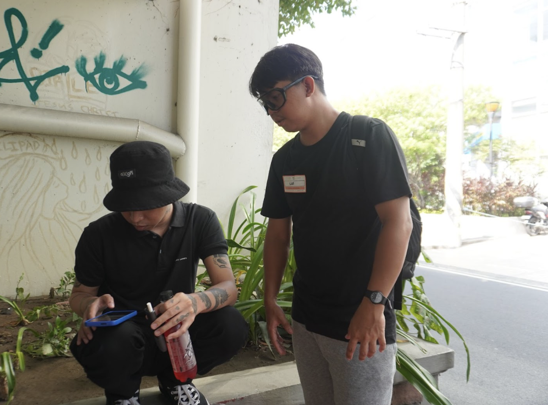
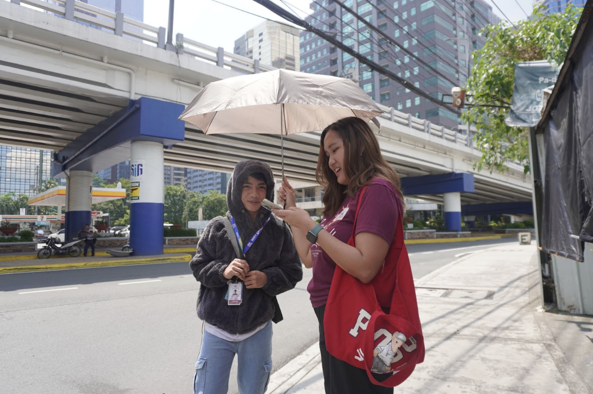
By calling for volunteers, the project engaged residents of the project cities, active mobility advocates, and other interested community members, who were guided by the SPARK team to document their observations and experiences in specific areas on a map.
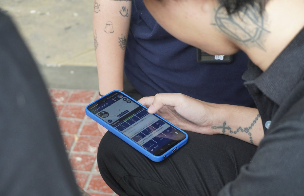
A walkability app to review your streets
In August 2025, the SPARK Project conducted the assessments using the Walkability app developed by Walk21. The app, which is free to download, allows users to input their walking experience on a map. When other users open the app, a map is shown with all the information left by other users.
The app guides users’ “street reviews” with a short questionnaire, including how comfortable they are walking there, how safe they feel, and what physical features of the street they like or don’t like.
The app also allows users to act as interviewers. When a user has the “interviewer mode” on, the questionnaire they normally see as an individual user changes to a different type of questionnaire meant to be used as a survey to gather input from other people as responders.
Using this feature of the Walkability app, the SPARK team and volunteers collected more than 800 responses using their own smartphones in four target sites in Quezon City and Pasig City. These responses, currently under analysis, will enrich multilevel walkability datasets gathered through complementary tools, helping paint a more complete picture of each street’s overall walkability.
What cities gain: Data that builds community
Based on SPARK’s experience, community mapping offers local governments four clear benefits:
1. Localized data: It provides micro-level data on assets, barriers, and priorities for walkability directly from residents and frequent users. This contributes to a richer understanding of stakeholders’ needs and supports evidence-based planning, ensuring public spaces meet the needs of the community, to effectively allocate public resources.
2. Easy-to-use visual data: Visualization through mapping can uncover trends that may not be seen in raw datasets. Using an open-access digital platform like the Walkability app also makes it more convenient for decision-makers and stakeholders to access data, as the app already organizes and analyzes information within just a few clicks. This, versus the slower manual encoding and calculation of pen-and-paper surveys.
3. Inclusive participation: With proper orientation, communities can easily take part, encouraging them to be involved in local planning and governance. When stakeholders co-create solutions with their local governments, public support and trust are developed from meaningful community engagement and transparency in the planning process. As SPARK volunteer Ariane Joyce Kekim noted, partnering with local organizations, community groups, and businesses strengthens community involvement.
4. Shared ownership: Active participation reminds stakeholders of their collective responsibility for public spaces. Like other participatory methods, community mapping instills a sense of community and ownership, contributing to a project’s long-term sustainability. Lui Rances, another SPARK volunteer, said community participation in city planning and design encourages people to help maintain improvements and abide by the policies they co-created.
An appetite for civic engagement
When asked about their motivations for joining the SPARK walkability assessment, volunteers shared a common answer: They wanted to help their city improve its streets.
The SPARK Project’s experience in mobilizing volunteers is an example of how communities, when given the right opportunity and platform, are willing to work with their local governments in improving public spaces, especially when it comes to their streets and the immediate environment that shapes their daily lives.
Community mapping offers a simple way for local governments to invite stakeholders into planning from the outset while filling critical data gaps. It can be the first step in integrating more participatory tools and methods towards sustainable and inclusive mobility planning, and sparking tangible changes on the streets people walk every day.
*Featured image credit: Jameela Antoniette Mendoza